Article 2 in a series on the Arlington, MA Master Planning process. Prepared by Barbara Thornton
Arlington, relative to other communities in the region, is a densely developed residential suburb with some commercial centers and a variety of interesting, walkable neighborhoods spread over a topography of hills, streams, ponds and flat lands. The Town’s property tax revenue pays for about 76% of the cost of operations, a relatively high percentage made more challenging because the Town has little room to add new property tax generating uses such as commercial or industrial development, and state law limits the growth in revenue from property tax to 2.5% a year, less than many of the inflationary costs local governments must cover.
The four goals for the land use section of the Master Plan are to 1) Balance housing growth with other supportive services and amenities; 2) Encourage development that enhances the quality of Arlington’s natural resources and built environment; 3) Attract development that supports and expands the economic, cultural and civic purposes of the commercial areas; 4)Focus mixed use development in Arlington’s commercial areas to support local businesses and provide services for residents. While Arlington has little open land that could be buildable for new tax revenue, it does have commercial areas that could be more densely developed, adding to the community’s revenue base.
Arlington’s topography also suggests some untapped and underutilized amenities for the community. Citizens value the historic character of the town but also want to ensure revenue to support the town’s future. Redevelopment opportunities exist that could enhance characteristics the community cherishes while adding expansion and diversification to the tax base. These opportunities will require an update to the old fashioned, linear approach to land use regulation outlined in the town’s current regulations. Access to open space and recreation amenities like Mill Brook and the Minuteman Bike Way can be enhanced with the right kind of redevelopment program.
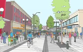
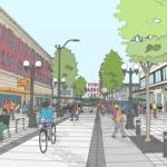
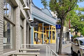
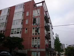
A modern approach to land use can also improve the revenue generating opportunities and visual amenities along the Mass Ave. commercial corridor in specific nodes, like Arlington Heights, Arlington Center and Capitol Square in East Arlington, without disrupting the quality of life in adjacent residential neighborhoods. The current zoning map includes 19 different types of districts such as “Town House”, “Industrial”, “Vehicular Oriented Business”, etc. (See page 4, table 2.1 of the revised Land Use Working Paper so see the full list or the current Zoning Map on pg 10-11 of the Existing Conditions report). The zoning plan was essentially an effort to describe what existed at that time, starting in 1975. Some districts were so small, they only had one parcel. Arlington’s current zoning use regulations are unusually restrictive and don’t now match the actual use of land. For example, 49 acres are zoned for industrial development but only 14 acres are actually used for industrial purposes and 20% of the business zoned land is used for residential purposes. Old fashioned zoning tools no longer fit the Arlington of today.
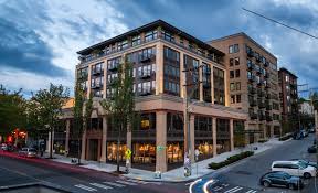
Fortunately, zoning policy has evolved considerably since 1975. New techniques such as “form based codes” give a community the vocabulary to talk about neighborhoods and how the citizens want that neighborhood to look and feel when they are in it. “Mixed Use Development” is another tool that would allow the Town to regulate the use of residential units above commercial store fronts, a contemporary concept for walkable village areas, bringing a more vibrant street life both day and night. New planning approaches also allow a more flexible conversation about density, design elements, massing, transitional areas and other characteristics of the built environment that are hard to address just by dimensional requirements like minimum lot area requirements, side yard dimensions, building height, etc.
As the Town uses the Master Planning process to reconcile the challenges of growth, change, revenue, amenities and quality of life for the future, the community will face the opportunity to rewrite its antiquated zoning and land use regulations. The shared vocabulary provided through the Master Plan will make this easier. Currently Arlington is divided into separate “pods” of singularly defined land uses called “zoning districts” such as commercial, residential, institutional, agricultural and industrial.
Modern land use regulation moves toward language to describe the
relationship between buildings and the “public realm” (streets, open
spaces, civic places), the form and mass of buildings in relation to
each other, and the type and purpose of streets and blocks. According to
the RKG consultants’ working paper, “ Form-based codes focus on the
form of a place, including the space between buildings that make up the
public realm, such as where the building sits on a lot, the frontage,
sidewalk, planting area, drainage, and the street itself. Form based
codes also consider the scale of blocks in order to create walkable
places.
A close look at the Town through the lens of the Master Planning process
and using an updated vocabulary to define ways of regulating land use
shows many terrific new opportunities for the Town in the future.
Each week, for the next several weeks, we will review the goals,
findings and opportunities associated with each of the following
sections of the Master Plan.
• Land Use existing conditions
• Economic Development
• Housing
• Open Space
• Historic and Cultural Resource Areas
• Public Facilities and Services
• Natural Resources