This 102 page document is the most recently revised set of recommendations by the Town of Arlington’s Redevelopment Board. The report takes into consideration the comments and information provided over the last few months’ public hearing process. It also incorporates a citizen petition which strengthens the case for increasing permanent affordable housing with the passage of these zoning related Articles. Town Meeting convenes on April 22, 2019.
Related articles
(By Vince Baudoin and James Fleming)
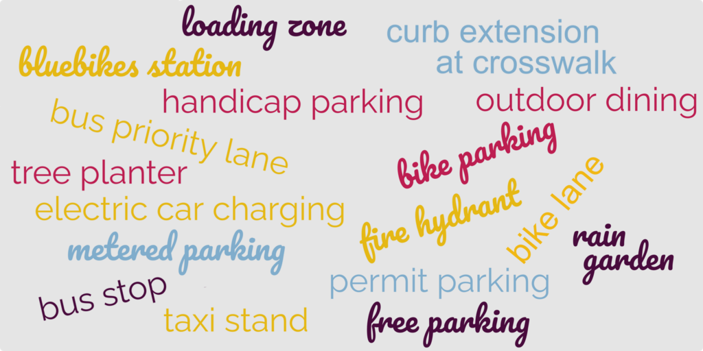
Could Arlington be better using its curb space? Here are some ways the curb can be used to create green infrastructure, promote public safety and accessibility, support sustainable transportation, strengthen business districts, and enable new ‘car-light’ development.
Roughly six inches high and made of concrete or granite, the curb marks the edge of the roadway, channels runoff, protects the sidewalk, and gathers stray leaves. When not assigned any other use, the space in front of the curb it usually serves as free storage for personal automobiles.
Yet the humble curb is a limited resource that can serve the community in many more ways. Have you thought about how your town budgets its curb space? For that matter, has your town thought about how it budgets its curb space?
While Arlington mostly uses its curb space for parking, some areas have other curb uses designed to achieve a specific goal. Consider the streets you use often. Have you seen an unsolved problem, or a missed opportunity, that a different use of the curb could help solve?
Create green infrastructure
The Town has miles of paved roadway. When it rains or snows, water runs into storm drains, carrying salt, oil, and other pollutants with it. The storm drains dump these pollutants directly into long-degraded waterways such as the Mill Brook, Alewife Brook, and the Mystic River. The Public Works department struggles to keep grates clear and drains from overflowing.
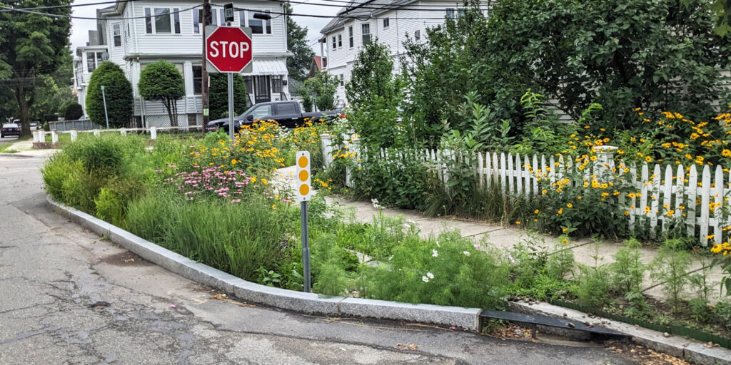
One solution: Use the curb for more greenery! The curb can be extended to create a rain garden or tree planting strip. The rain garden helps slow runoff and filter the water before it enters the drain, while trees benefit from additional room for the roots to grow without damaging the sidewalk. A side benefit: narrowing the street encourages drivers to slow down, making neighborhoods safer.
Promote public safety and accessibility
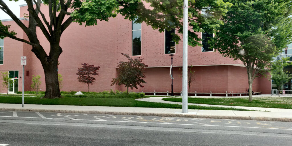
Often, portions of the curb are set aside for public safety purposes. For example, a fire lane provides fire department access to key buildings, such as the high school, shown below. Fire hydrants also enjoy special curb status.
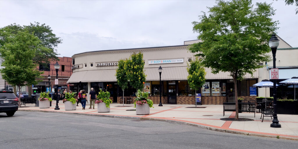
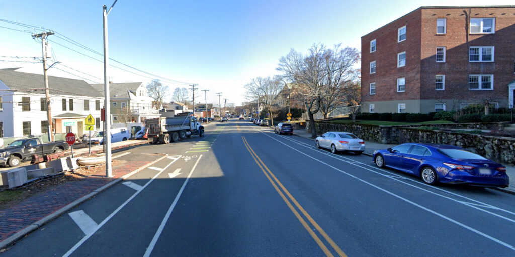
Other times, no-parking zones are established to enhance the free flow of traffic, such as here at Broadway Plaza:
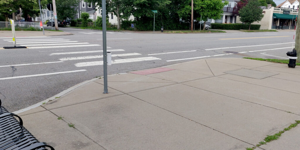
Where pedestrian crosswalks are present, a curb extension is a key safety enhancement. By narrowing the roadway, the curb extension encourages drivers to slow down and look for pedestrians. For pedestrians, it reduces the distance they must cross and prevents cars from parking directly next to the crosswalk and blocking visibility.
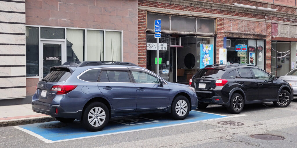
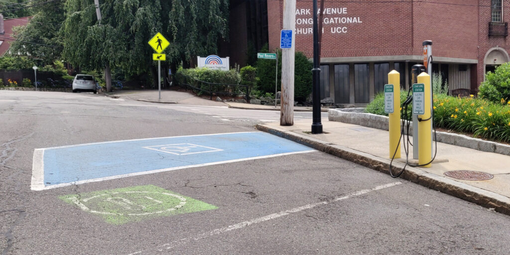
Finally, accessible parking spaces can be created along the curb. Arlington has at least 50 designated permit-only on-street parking spaces that provide convenient parking for residents with mobility issues or other disabilities.
Support sustainable transportation
When the curb is mostly used for cars, it is easy to overlook how curbside facilities can enhance other forms of transportation.
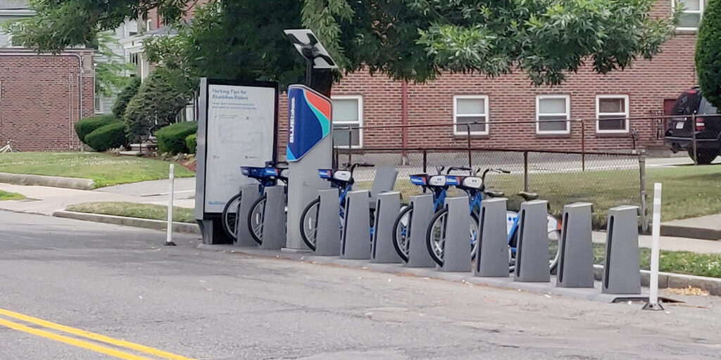
In the space of one or two parked cars, this bikeshare station offers space for 11 bikes. However, because it is installed on the roadway, it must be removed every winter so that snow can be cleared. If the curb were extended, the bikeshare station could be used year-round. Another nice feature is bicycle parking: the space to park one car can be used to park six or more bicycles.
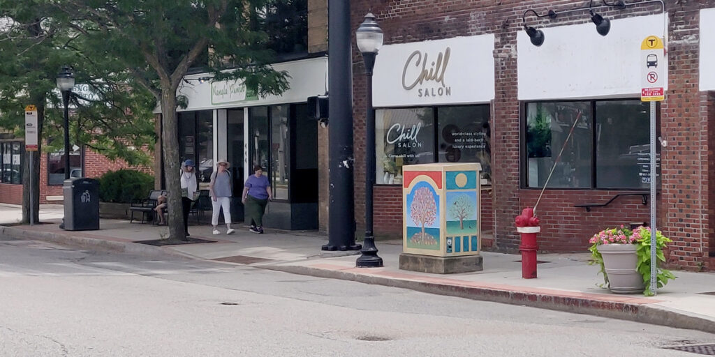
A bus stop allows buses to pull to the curb. In some cases, it is appropriate to extend the curb so the bus would stop in the traffic lane; otherwise, it may experience delays when it merges back into traffic.
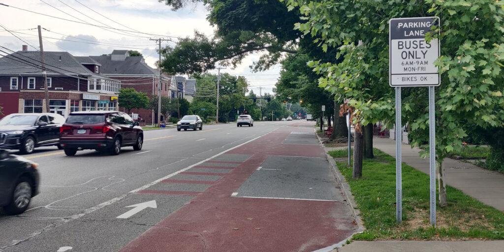
A bus priority lane provides a dedicated right of way for buses, helping to improve on-time performance. To date, these lanes extend only a few hundred feet into Arlington along Mass Ave. They have proven beneficial in many other communities.
Bike lanes, particularly if they are separated from cars by a physical buffer, greatly enhance the safety and comfort of people traveling on two wheels.
But with a limited roadway width, adding bike lanes is difficult unless the community is flexible enough to consider consolidating curb parking on one side of the street, or moving it to side streets entirely.
Finally, the Town could expand the use of on-street spaces for electric vehicle charging stations, such as this one on Park Ave:
Strengthen business districts
Nowhere is the curb more valuable than in business districts. Businesses thrive when their customers have a convenient way to reach them. Metered parking encourages people to park, do their business, and move along so another patron can take that space. Revenue from parking meters can be spent to improve the business district–for example, by planting flowers and trees.
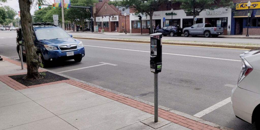
Metered parking is not the only valuable use of curb space in a business district. Outdoor dining is a way the Town can directly support its restaurants by enabling them to serve additional customers. Here is one example in Arlington Center:
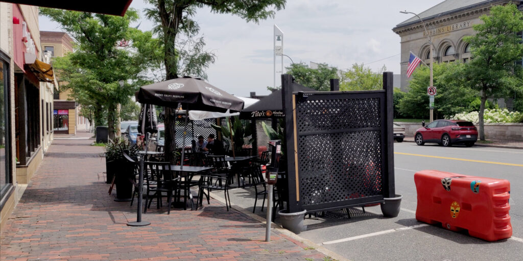
And in Arlington Heights:
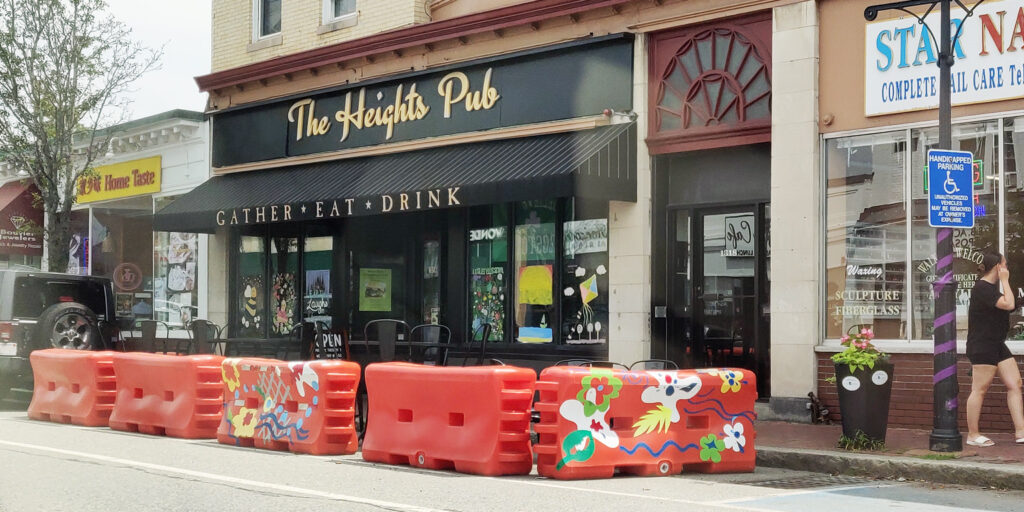
Other valuable curb uses in business districts include taxi stands and loading zones. Loading zones in particular are crucial to businesses’ success and help prevent the street from being clogged by early-morning delivery trucks, late-night food-delivery vehicles, and everything in between.
Enable new ‘car-light’ development
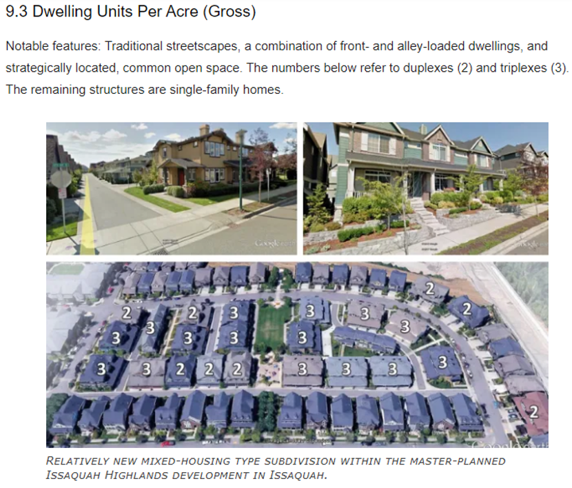
With high housing costs and a relatively small commercial tax base, Arlington could benefit from some kinds of development. However, land is valuable and lots are small, so if new buildings are required to have large parking lots, it is very difficult to build new homes and businesses. Plus, large parking lots bring more cars and more traffic. But better curb management can help resolve this dilemma, supporting car-light development that is more sustainable and affordable.
For example, on-street permit parking can enable nearby development with few or no off-street parking spaces. New housing or businesses are a better use of land than parking and will generate more property tax revenue. When parking permits are priced appropriately, they are available to residents who need them but discourage households from adding extra cars they do not need.
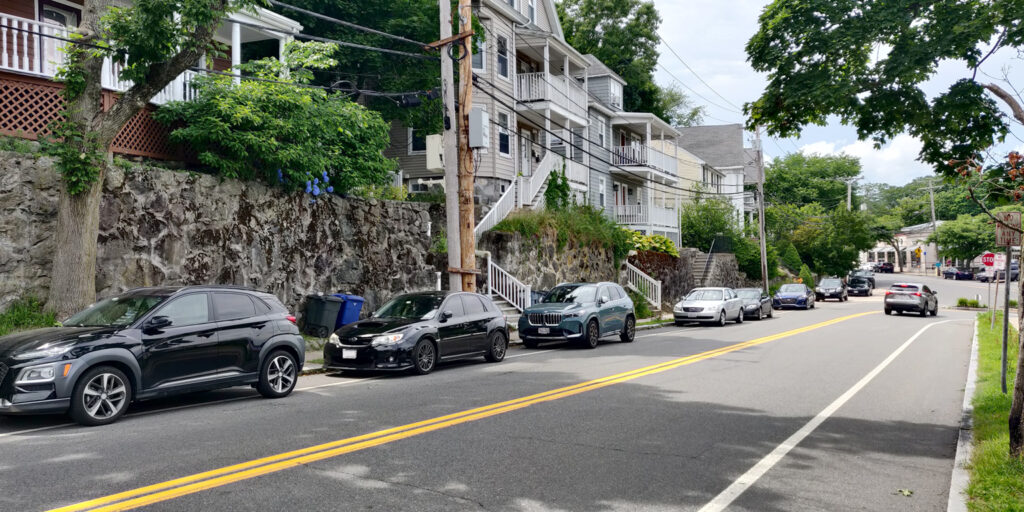
Take these hillside houses: access to on-street parking made it possible to build on a steep hillside, where it would have been too expensive and difficult to blast to create off-street parking.
Conclusion
Ask your town leaders if they have a curb management strategy. Is the Town using its limited curb space in support of goals such as green infrastructure, public safety and accessibility, public transportation, local business, and car-light development?
from Karen Kelleher, Reporter
Interested in new policy developments on housing production in the Greater Boston area? The latest research from Mass Housing Partnership (MHP) is of interest. They just released (Dec. 18, 2019) in interactive map showing relative housing density around every mass transit and commuter rail station in the system, concluding that the region could add 235,000 units if every community allowed density as of right in the area around transit.
CHAPA has legislation pending that would require municipalities served by transit to allow higher density as of right within a certain distance from transit stations. You’ll see that the density around Alewife is not too bad in the context of the entire system.
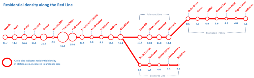
This is mostly because of very high density in Cambridge near Alewife, but the density of two and three families in East Arlington shows better housing density than the sea of single family zoning around many commuter rail stops.
You can check it out here:https://www.mhp.net/news/2019/todex-research-brief
Two weeks ago, I helped to organize a precinct meeting for residents and town meeting members. During the meeting, we got into a discussion about public open spaces, how the town funds their upkeep, and whether having more commercial tax revenue might provide additional funding for parks and recreation.
As I discussed in an earlier post, only about 5.6% of Arlington’s is zoned for commercial uses, and that limits the amount of commercial property tax revenue we can generate. Commercial property tax revenue is sometimes referred to as “CIP”, which stands for “Commercial, Industrial, and Personal”. Commercial and Industrial refer to property taxes on land and buildings that are respectively used for commercial and industrial uses. Personal tax is tax on the value of equipment that’s owned and used by a business for the purpose of carrying out whatever their business is. This could include things like desks, display fixtures, cooking equipment, fork lifts, and the like.
In 2020, Arlington’s CIP levy was 5.45%, meaning that 5.45% of our property tax revenue came from Commercial, Industrial, and Property tax revenue. Breaking this down further, 4.2% was commercial ($5,562,528 tax levy), 0.2% was industrial ($278,351 tax levy), and 1.1% was personal ($1,423,117 tax levy). The town’s total 2020 tax levy was $133,350,155. This data comes from MassDOR’s Division of Local Services, and I’ll provide more specific sources in the “References” section of this post.
A CIP levy of 5.45% is low (compared with other communities in the commonwealth), and occassionaly folks like to talk talk about how to raise it. Which is to say, we about how to raise the ratio of commercial to residential taxes. I moved to Arlington in 2007, when our CIP levy was 5.37%. This increased in subsequent years, peaking at 6.26% in 2013, and has been gradually decreasing since. Recall that 2008 was the year the housing market crashed, and the “great recession” began. The value of Arlington’s residential property fell, but the value of business properties was relatively stable in comparison. Thus, our CIP percentage got a boost for a couple of years.
Tax levies (the amount of tax collected) are a direct reflection of the tax basis (the assessed value of property). I’m going to shift from talking about the former to talking about the latter, because that will lead nicely to a discussion about property wealth. Which is to say, the aggregate value of property assessments in town.
Here’s a chart showing Arlington’s net CIP and residential property values, from 1983–2020, adjusted to 2020 dollars. (This is similar to the chart that appears on page 102 of Arlington’s Master plan, but for a longer period of time).
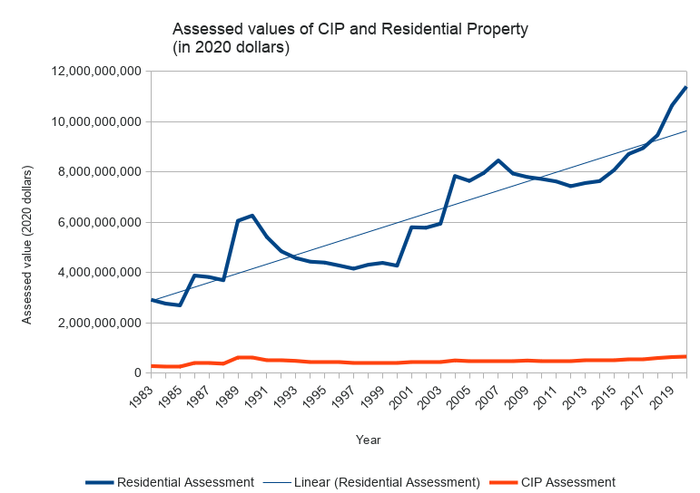
Generally speaking, the value of Arlington’s residential property has appreciated considerably, and there’s a widening gap between our residential and CIP assessments (in terms of raw dollars). Because the gap is so large, it’s helpful to see it on a log scale.
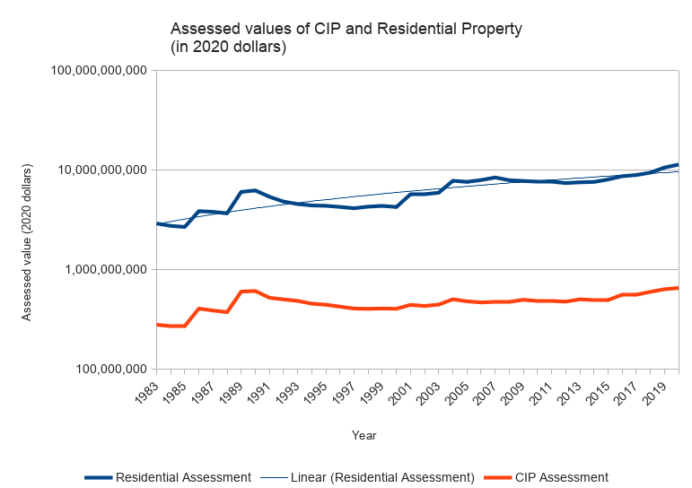
Viewed this way, the curvatures are generally similar, but residential property wealth is rising faster than business property wealth.
In summary, there are three reasons why our CIP is as low as it is: (1) a limited amount of land where one can run a business, (2) the value of residential property is appreciating faster than the value of business property, and (3) occasionally business properties are converted to residential (perhaps with the residential property being worth more than the former business property). That’s not to say we can’t improve the commercial tax base. We can, but we will have to think about what and where, and how to compete with a generally competitive residential market.
References
- MassDOR Division of Local Services reports
- DOR Query Tool for Municipal Property Assessments
- DOR Query Tool for Municipal Tax Levies
- Spreadsheet of Arlington Property Assessments, 1983–2020. Data obtained from MassDOR, with calculations added to adjust for inflation.
- Spreadsheet of Massachusetts Property assessments for 2020. Data obtained from MassDOR.
(Updated 7/2/2020, to add log scale graph and revise conclusion.)


by Andy Greenspon
Image credit: Henry Hudson Kitson, Public domain, via Wikimedia Commons

In 2023, Lexington was one of the first towns to comply with the State “MBTA Communities” law (MBTA-C) by adding 227 acres to several multifamily overlay zones. When discussing this proposal, it was estimated to possibly generate 400-800 units in 4-10 years. However, after receiving building permit applications for about 1,100 units in the first year (including 160 inclusionary affordable units), Lexington passed Article 2 at a Special Town Meeting recently, which decreased the amount of land in these zones to approximately 90 acres. What can Arlington learn from Lexington’s experience?
Overall, Lexington’s experience shows us that developers are willing and able to build multifamily housing on large lots that aren’t very built up, and that MBTA-C can be successful in adding new housing in some circumstances. However, Arlington has few if any large, sparsely-built parcels zoned to allow multifamily housing under MBTA-C. As such, Arlington is unlikely to add significant amounts of new housing or affordable housing as a result of the MBTA-C overlay passed at Town Meeting in fall of 2023.
Parcel Size and Existing Buildings
Many of the parcels in Lexington’s MBTA-C zone are multiple acres each, are underutilized, and contain older office space. In contrast, Arlington’s MBTA-C parcels are much smaller and mostly covered with existing buildings, typically residential.
The largest development approved under MBTA-C so far in Lexington is at 3-5 Militia Drive. This land is three very large parcels containing a couple older office buildings, a previous religious institution, and giant surface parking lots. Therefore, such a property was already primed for redevelopment and the large lots allowed for 292 units to be approved. These parcels are also within walking distance of Lexington Town Center and the Minuteman Bike path, so multi-family housing on this location is a great use.
In contrast, there are no similar parcels in Arlington in the MBTA-C zone with large surface parking lots and aged office space that could be redeveloped in such a manner. One of the few parcels in Arlington that is somewhat similar to the planned parcels for redevelopment in Lexington would be the Walgreens at 324 Massachusetts Ave, 1.5 acres with a surface parking lot. However, this parcel was specifically excluded from the MBTA-C overlay along with all other business parcels to avoid displacing any existing business space. And the parcel is unlikely to be redeveloped one way or another unless Walgreens chooses to close their business and sell the parcel to a developer.
In short, compared to Lexington, Arlington is “built out” insofar as almost every parcel is utilized in some manner with high lot coverage. The original Lexington MBTA-C zone contained many parcels with low lot coverage, large surface parking lots, and underutilized office space, all attributes that make such parcels more likely to be sold to a developer to construct housing if permitted by zoning.
Last, while 1,100 units have been permitted so far, this does not mean all these units will be constructed given current financial uncertainty in the economy and high interest rates. It will also take several years for these properties to be completed and prepared for occupancy. As such, the original estimate of 400-800 units in 4-10 years (an estimate that actually widely ranges from 40 units all the way to 200 units per year) may in fact not be that far off from the final numbers once buildings are completed. The parcels most primed for redevelopment were acquired and permitted first. Finally, it is not entirely clear how many more parcels would have been redeveloped in the next 5-10 years had the Lexington MBTA-C zoning not been reduced in size.
Development Potential in Arlington
Most privately owned lots in Arlington are less than ⅓ of an acre with many much smaller, significantly limiting the amount of new housing development on any single parcel. Almost all of these lots are covered by existing buildings, and some of those buildings are condominiums. Therefore, in order for a large new construction project to occur on such parcels in Arlington’s MBTA-C multifamily zone, all of the following would have to take place:
- a single owner would have to take control of multiple lots and/or condominiums, meaning that
- multiple existing property owners would have to want to sell at the same time, or else the new owner would have to take the time and risk to assemble the property slowly, and
- the new proposed development would have to be large and profitable enough to make up for the combined purchase prices of all the properties acquired.
Meanwhile, properties in Arlington generally turn over at a fairly slow and steady pace. This is in contrast to underused large commercial properties, whose owners are more eager to sell.
With simulation modeling performed on potential rate of redevelopment, the Arlington Redevelopment Board’s 2023 Report to Town Meeting on the MBTA-C proposal projected that 15–45 parcels could be redeveloped over the next ten years, for a net increase of 50–200 new units or 5–20 per year, far fewer than even the initial Lexington housing unit construction estimates at the time of passage of their initial MBTA-C zoning.
In fact, Arlington has seen even less than the low end estimate of 5 units per year so far since our MBTA-C zoning became effective. Only a single project has been permitted so far, which would turn an existing 2-unit building into 4 units, a potential net gain of 2 housing units.
Lessons
- There is strong regional demand for housing including for multifamily units.
- Developers are currently willing and able to build when lots are available, are zoned multifamily, and aren’t already full of other buildings.
- Arlington can’t expect anywhere near as many new units with our current zoning as Lexington saw, because our MBTA-C multifamily zones are almost exclusively made up of smaller and built-up lots.
- As a result, Arlington’s current zoning won’t add much housing or affordable housing to our community, and won’t noticeably increase our tax base either.